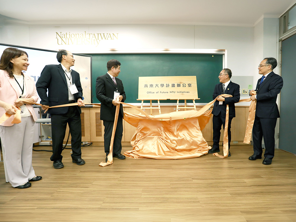
Inauguration of the Office of Future NTU Initiatives at National Taiwan University
瀏覽器版本過舊,或未開啟 javascript
請更新瀏覽器或啟用 javascript
Spotlights
Date: 2016/7/21
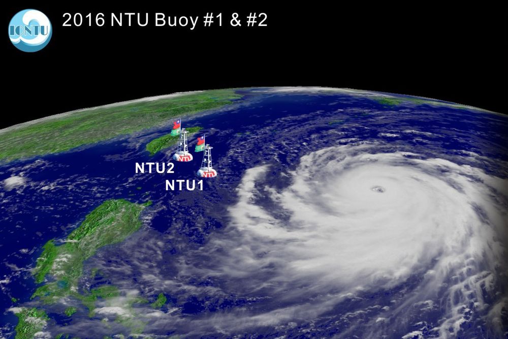


Locations of the two NTU buoys in relation to Typhoon Nepartak.
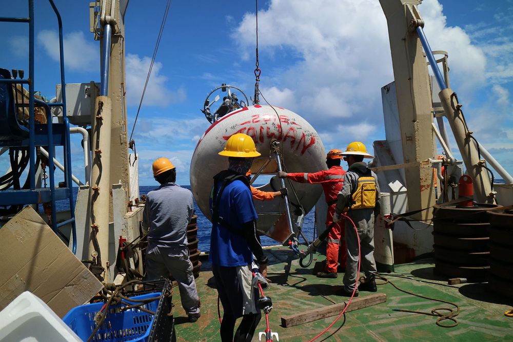
Image of second generation NTU data buoy at work in the ocean.
One buoy ready to be deployed on the afterdeck of R/V Ocean Researcher I.
Wen-Hua Ho (right) mounting a current meter onto the cable.
Marine technicians work on the buoy in the midst of the Pacific Ocean.
The buoy team led by Dr. Yiing-Jang Yang (right) on board R/V Ocean Researcher I .
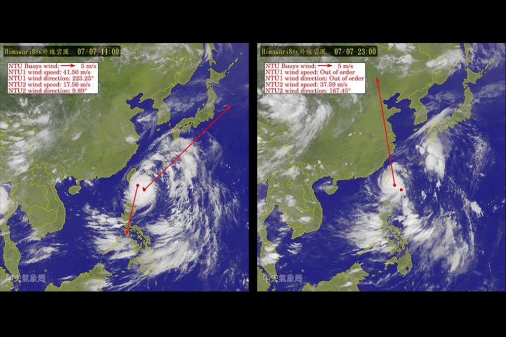
Wind velocities measured by the buoys when Typhoon Nepartak enveloped and passed by the buoys.
Real-time data transmitted from NTU2 buoy during July 4-7.
Two weather and ocean observation buoys set up by a team from NTU’s Institute of Oceanography provided rich and unprecedented data that is helping scientists analyze the intensity and progression of Super Typhoon Nepartak.
On July 8, the super typhoon, which has been described as one of the strongest tropical storms to hit the western region of the North Pacific, slammed the southeastern region of Taiwan, killing two, wounding 72, and causing more than NTD 700 million (approx. USD 21.8 million) in damages.
In the aftermath of Typhoon Nepartak, the accuracy of the typhoon forecasting performed by the Central Weather Bureau of Taiwan is, again, subject to criticism. However, the precious and abundant in situ atmospheric and oceanic data that was collected by the two buoys and that was transmitted back to the Institute in a real-time manner must help to improve the timeliness and accuracy of typhoon forecasting.
The two buoys are the second generation of environment-observing and data-capturing devices which have been developed and improved upon since early 2015 by a research team led by Institute of Oceanography Director Ching-Ling Wei (魏慶琳) and Associate Professor Yiing-Jang Yang (楊穎堅). The air-sea observation buoys were deployed from the research vessel R/V Ocean Researcher I into the western North Pacific in late June of this year as part of the team’s long-term project to observe typhoons directly from the ocean.
The buoys, NTU1 and NTU2, were moored about 375 km and 175 km, respectively, from the southernmost tip of Taiwan. These locations were chosen because they lay in the path or track that a typhoon would most likely take, as predicted by analysis of data pertaining to previous typhoons from prior, strong El Niño years.
Just one week after the deployment of the buoys, Typhoon Nepartak formed and gathered strength rapidly, quickly gaining the status of a “super typhoon” while traveling towards Taiwan from July 4-8. The typhoon’s center passed within a few kilometers of the buoys’ locations, and the two NTU buoys directly observed the behavior of this super typhoon, all the while transmitting data back to the ground station through an Iridium satellite communication system at 18-minute intervals.
The NTU researchers point out that real-time observations such as these have been extremely rare in the history of in situ typhoon observation, particularly with data buoys on the open sea.
On July 6, NTU1’s atmospheric and oceanic sensors picked up important data from Typhoon Nepartak. The data revealed that the storm had an air pressure of about 940 hPa, a maximum wind gust of 41 m/s (~148 km/h or ~82 knots), and that it produced a drop in seawater temperature from 31°C to 28°C in the depths of the ocean’s upper 100 m.
As Nepartak raged on and approached NTU2, the second buoy recorded a surprisingly low air pressure of less than 900 hPa and a maximum wind gust of 44 m/s (~158 km/h or ~88 knots). In addition, the seawater in the upper 120 m was stirred vertically by the fierce winds.
This valuable data set was immediately passed on to Taiwan’s Central Weather Bureau, where it could be fed into the bureau’s forecasting model for improved predictions. The data gathered by the two buoys was also presented on the Institute’s website in real-time as it became available.
The international tropical-storm research community also took instant note of the buoys’ remarkable real time observations, as well as the buoys’ exceptional durability in weathering the typhoon’s attack. The success of the project eventually gained documentation on Wikipedia : “... the typhoon [Nepartak] passed near a buoy near Orchid Island. The buoy observed a minimum pressure of roughly 897 hPa (26.49 inHg). This observation awaits verification by a National Taiwan University team”.
According to the research team, this unprecedented set of data is of particular importance because it will help scientists better understand, among other things, the atmospheric conditions near a typhoon’s center, the heat exchange between the atmosphere and the ocean during a typhoon, and the upper ocean’s responses to the high winds of a super typhoon.
It is hoped that this new-found knowledge of the typhoon’s properties and dynamics can soon lead to improvements in numerical forecasting models, and thereby increase the accuracy and timeliness of typhoon forecasts in general.
This buoy project, which has so successfully observed Super Typhoon Nepartak, is an implementation of the spirit of service and altruism encouraged by the NTU’s President Pan-Chyr Yang (楊泮池).
Inauguration of the Office of Future NTU Initiatives at National Taiwan University
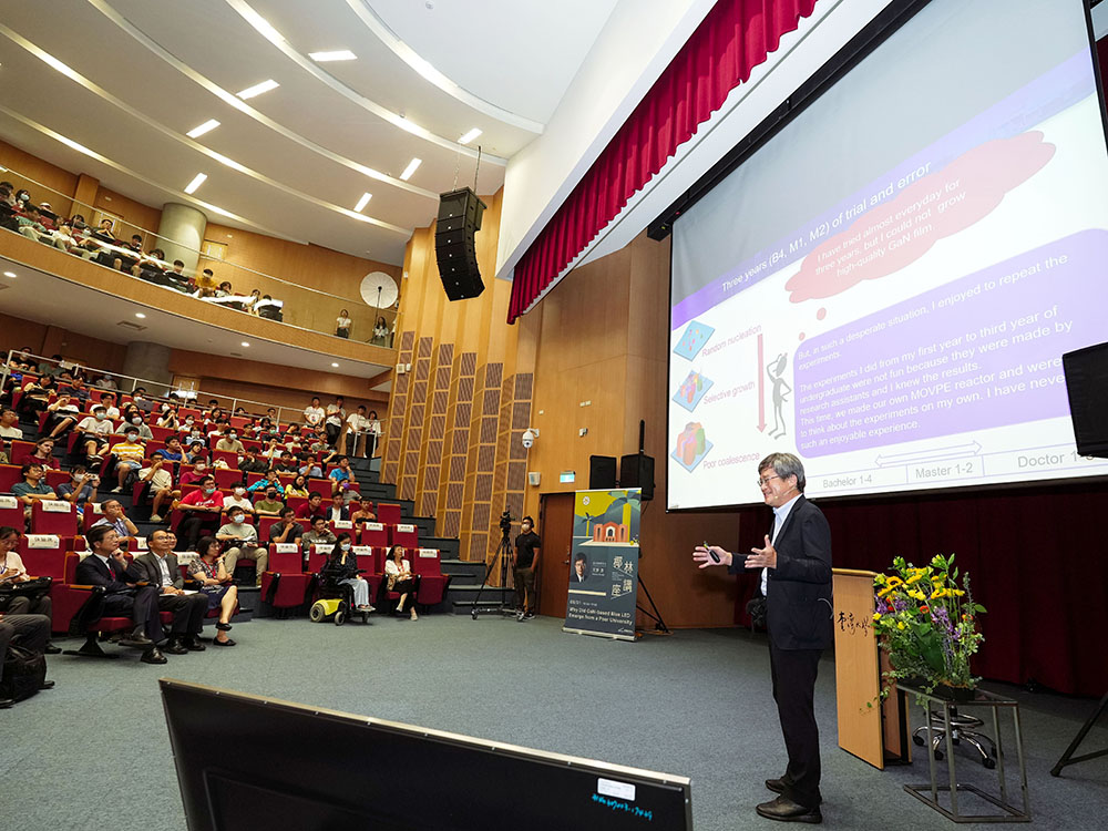
Nobel Laureate Hiroshi Amano's Lecture Marks the Beginning of NTU Royal Palm Lecture Series
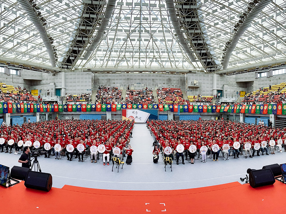
Opening Ceremony for the 112th Academic Year - Welcoming New Students to Become Part of the NTU Family

Vice President Shan-Chwen Chang was awarded the Third Class Order of Brilliant Star

Congratulations! Prof. Lou Pei-Jen receives 2023 National Excellent Teacher Award
Current Spotlights
Inauguration of the Office of Future NTU Initiatives at National Taiwan University
Nobel Laureate Hiroshi Amano's Lecture Marks the Beginning of NTU Royal Palm Lecture Series
Opening Ceremony for the 112th Academic Year - Welcoming New Students to Become Part of the NTU Family
Vice President Shan-Chwen Chang was awarded the Third Class Order of Brilliant Star
Congratulations! Prof. Lou Pei-Jen receives 2023 National Excellent Teacher Award