


A new milestone for science at NTU: The inauguration of the Max Planck-IAS-NTU Center
瀏覽器版本過舊,或未開啟 javascript
請更新瀏覽器或啟用 javascript
Spotlights
Date: Oct 2, 2015
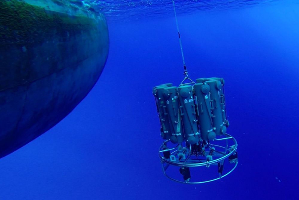
Conductivity-Temperature-Depth instrument in action to measure and detect the Kuroshio water.
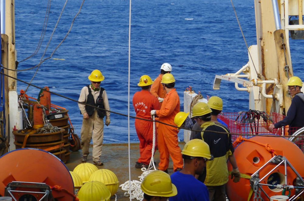
An acoustic Doppler current profiler on board NTU's R/V Ocean Researcher I off east coast of Taiwan.
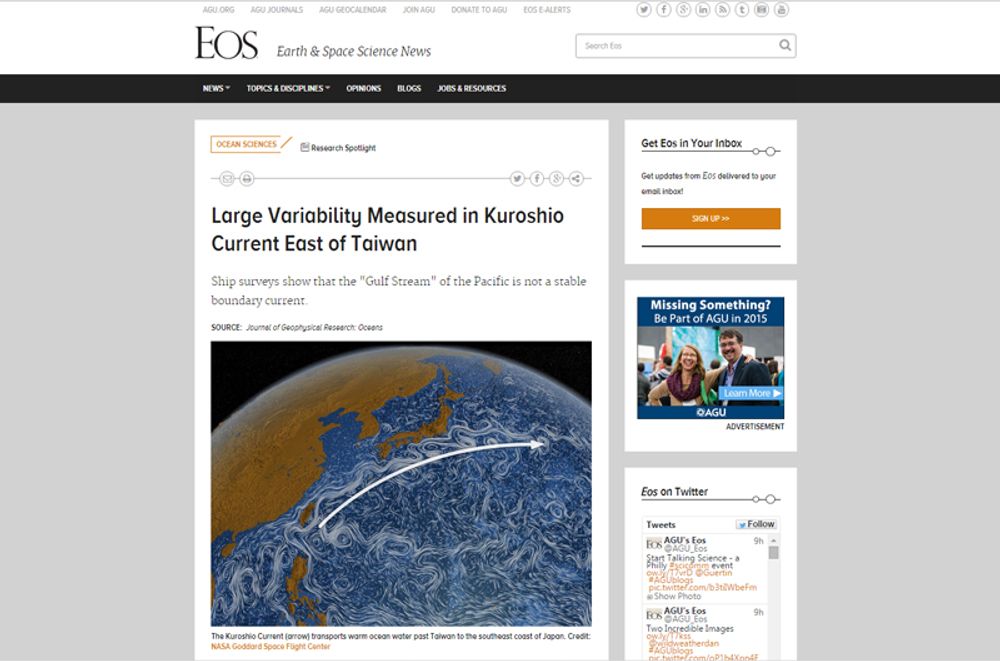
The paper was featured on the website of Eos Earth & Space Science News website.
An NTU oceanic study has shown that the Kuroshio Current is far more unstable than previously assumed. This important observation was published in the Journal of Geophysical Research - Oceans, featured as a Spotlight article on the journal’s website, and reported on the Eos Earth & Space Science News magazine.
The Kuroshio Current, which is known as the “Gulf Stream” of the Pacific, is a subtropical gyre at the western boundary of the North Pacific. Carrying a tremendous amount of water northwards, the current is in charge of transporting heat and salt from the tropical south to extratropical oceans. The Kuroshio plays an important role in terms of the environment, climate, and fisheries around the coastal regions of Northeast Asia; it also serves as the basis for the region’s weather prediction and management of fishery resources.
Despite its basin-wide importance, little in-situ measurements of the current has been made east of Taiwan. With this in mind, the NTU research team set out on a three year project that took it on 9 voyages between 2012-14 to gather data on the Kuroshio’s velocity, volume, flow structure, heat, and salt transport.
The data revealed a tremendous variability in this boundary current, including a maximum velocity varying between 0.7 and 1.4 meters/second, as well as a depth that fluctuates between 20-100 meters. In addition, the data shows that the distance between Taiwan's east coast and the maximum velocity position varies from 12 to 103 kilometers, and the current's width, as delineated by the 0.2 meters/second velocity contour, varies from 85 to 135 kilometers.
According to the researchers, this newly discovered in-situ data set is vital to the dynamic study of the Kuroshio variability and the validation of numerical simulations.
Members of the study includes Prof. Sen Jan (詹森), Yiing-Jang Yang (楊穎堅), Ming-Huei Chang (張明輝), and Joe Wang (王胄) of the Institute of Oceanography. The study was conducted under the Observations of the Kuroshio Transports and their Variability (OKTV) project, which was sponsored by the Ministry of Science and Technology.
A new milestone for science at NTU: The inauguration of the Max Planck-IAS-NTU Center

A Distinguished Global Research Center Established at NTU under Trilateral Cooperation
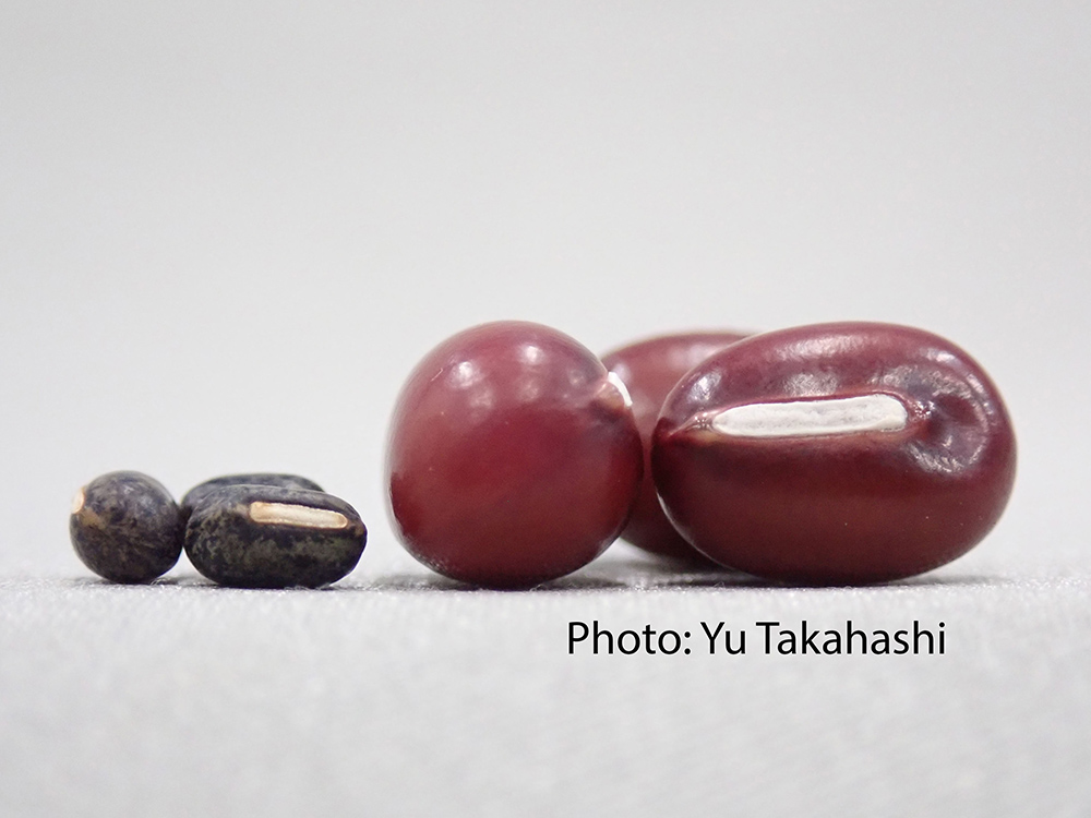
Collaborative study between NTU and Japan uncovers the origin of Adzuki Beans and agriculture in Japan
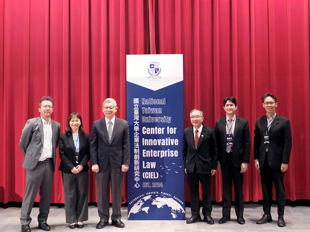
NTU Launches Center for Innovation in Enterprise Law—with Forum Highlighting Trump’s Policy and Legal Shifts Amid Geopolitical Tensions
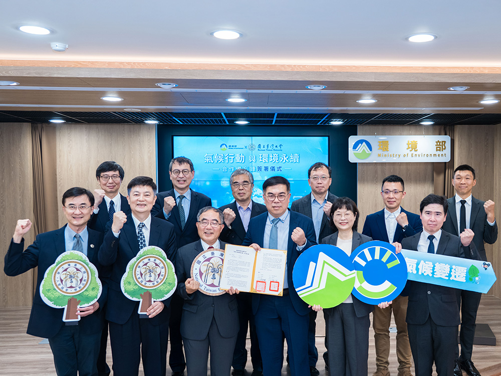
NTU and Ministry of Environment Sign MOU to Advance Net-Zero Transition and Environmental Resilience
Current Spotlights
A new milestone for science at NTU: The inauguration of the Max Planck-IAS-NTU Center
A Distinguished Global Research Center Established at NTU under Trilateral Cooperation
Collaborative study between NTU and Japan uncovers the origin of Adzuki Beans and agriculture in Japan
NTU Launches Center for Innovation in Enterprise Law—with Forum Highlighting Trump’s Policy and Legal Shifts Amid Geopolitical Tensions
NTU and Ministry of Environment Sign MOU to Advance Net-Zero Transition and Environmental Resilience