
NTU Achieves Record High of 54th in the 2027 QS World University Rankings
瀏覽器版本過舊,或未開啟 javascript
請更新瀏覽器或啟用 javascript
Spotlights
Date: Dec 20, 2017
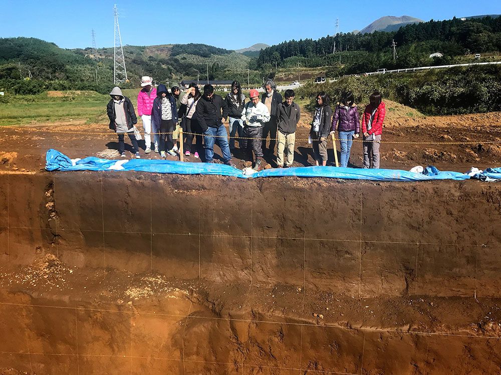

Students and instructors of the joint field course visited the trench site for studying the seismogenic fault of the Kumamoto earthquakes.
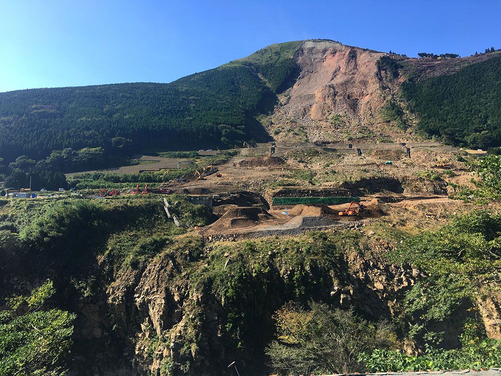
Large-scale landslide near the Aso Bridge.
Caldera of the Aso volcano.
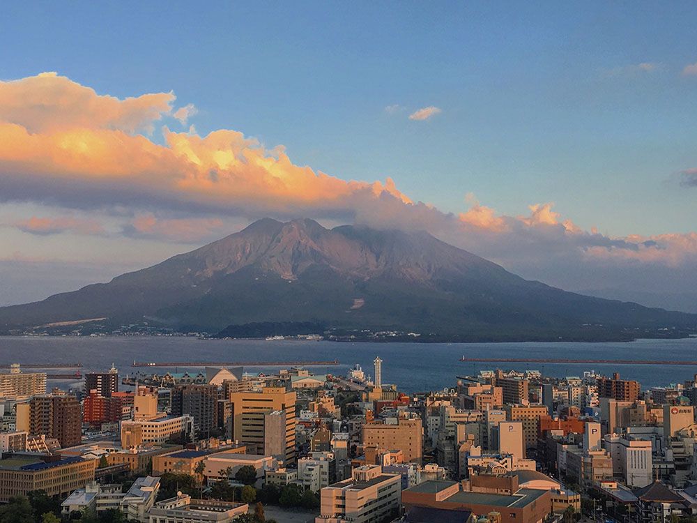
An overlook of the Sakurajima volcano.
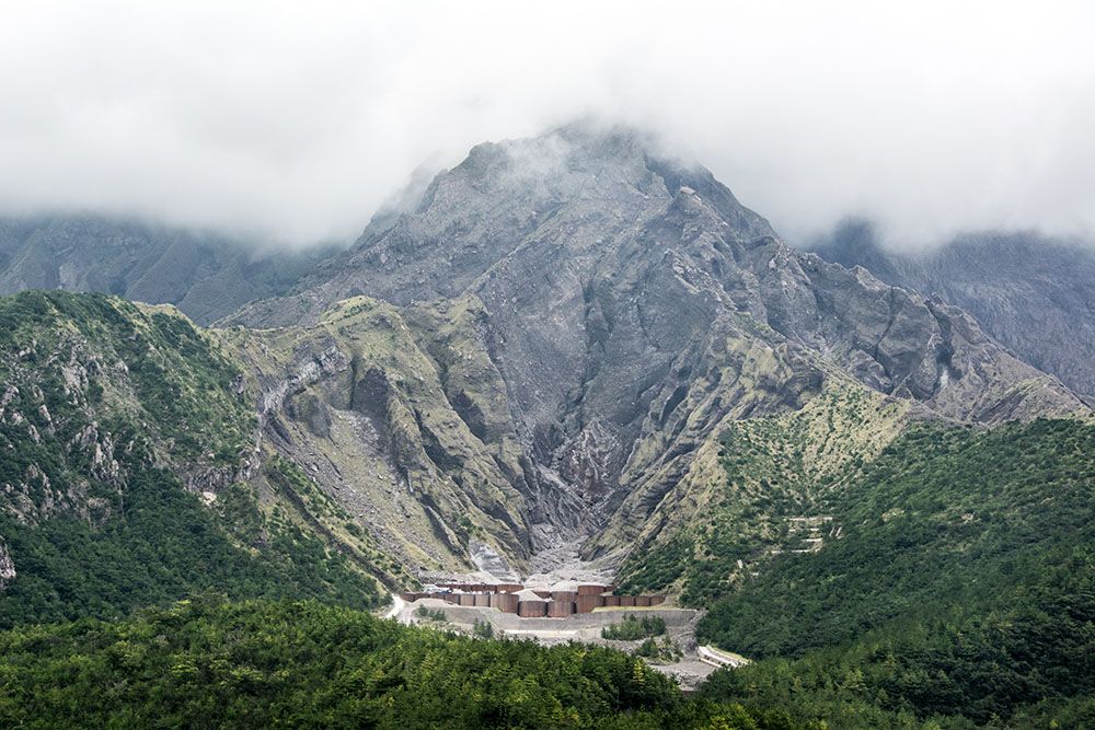
Construction of concrete check dams to the south of Sakurajima volcano.
The island of Kyushu, Japan, is located at the eastern end of the Okinawa Trough, close to the convergent zone between the Eurasian and Philippine Sea plates. As Kyushu and the island of Taiwan have similar tectonic settings, it is intriguing to compare their geomorphic and geologic features, which helps us better understand the tectonics of Taiwan. Thanks to the support from the NTU College of Science, Assistant Prof. Ray Y. Chuang (莊昀睿) led 10 undergraduate and graduate students of the Department of Geography to join a collaborative field course, “Special Topics and Research in Physical Geography,” with the Department of Earth and Planetary Sciences at Kyushu University in Kyushu, Japan in late October, 2017. In Japan, the field class was led by Prof. Kaoru Kashima (鹿島 薫) together with other Japanese professors and researchers. The course focused on the 2016 Kumamoto earthquakes (熊本地震) and the volcanic activities at Unzen (雲仙), Aso (阿蘇), Kuju (九重), Beppu (別府), Kirishima (霧島), and Sakurajima (桜島).
The field course started with a visit to the Shimabara Peninsula Geopark, where the Mt. Unzen Disaster Memorial Hall exhibits the history of the volcanic hazards of Mt. Unzen. We experienced the power of volcanoes and the related hazards via the Space Theater at the Memorial Hall. In addition, we visited an elementary school struck by pyroclastic flows and a village buried by post-volcanic debris flows, both of which have been preserved for later generations to “witness” the destructive power of the Unzen volcano.
In the Aso area, we visited the Aso Volcano Museum and learned the geology of Mt. Aso. The most famous geomorphic feature of the Aso area is the caldera topography, which was formed through subsidence processes due to the depletion of magma after a huge eruption. The 2016 Kumamoto earthquakes caused surface ruptures around Mashiki extending westward into the Aso caldera. We observed the surface cracks and damage along the rupture, and visited a trench site for studying the paleoseismology of the Futagawa-Hinagu fault, which is the seismogenic fault of the Kumamoto earthquakes.
To the north of the Aso caldera, we stayed at Kuju, where a series of volcanoes are situated along the Beppu-Shimabara graben. In this area, we visited the Hatchobaru Geothermal Power Plant, which is the largest thermal power plant in Japan. The plant currently has two operating units with 110 MW capacity. Most surprisingly, there is no operator in the plant, and all the operation is remotely conducted at the Odake Power Plant 2 km away from the Hatchobaru Geothermal Power Plant.
In the last days of the trip, we headed to Mt. Kirishima and Mt. Sakurajima in southern Kyushu. Mt. Kirishima is a volcanic group, and one of the active volcanoes, Shinmoedake (新燃岳), erupted one week before our visit. Therefore, we had the opportunity to observe the newly deposited volcanic ashes on the way. Mt. Sakurajima is a famous geomorphic landmark in the Kagoshima area. Mt. Sakurajima is the most active volcano in Japan in modern times. Sakurajima used to be an island situated in the Kagoshima Bay. In 1914, a massive eruption generated pyroclastic and lava flows, which filled the narrow strait between Sakurajima and the mainland, turning Sakurajima into a peninsula. We observed the geomorphic features of previous eruptions, and learned how local people respond to and prepare for future eruptions and associated debris flows.
The island of Kyushu has similar topography and tectonics to Taiwan. This field course provided an excellent opportunity for us to observe geologic and geomorphic features in the field and to learn how the Japanese government and society react to and live with volcanos, earthquakes, and other geologic hazards. We hope that this experience can help students and others gain more knowledge about the interactions between human and environment.
(Source: Assistant Prof. Ray Y. Chuang, Department of Geography, NTU)
NTU Achieves Record High of 54th in the 2027 QS World University Rankings

2026 NTU Commencement

Southern Ocean "Intermediate Water" Holds the Key to Earth’s Carbon Dioxide Changes

NTU Team Achieves a Highly Cycle-Stable Zirconium Dioxide Antiferroelectric Technology Capable of 100 Million Cycles

Nobel Laureate in Chemistry Joachim Frank Unveils the Legendary Path of Cryo-Electron Microscopy in Transforming Modern Medicine
Current Spotlights
NTU Achieves Record High of 54th in the 2027 QS World University Rankings
2026 NTU Commencement
Southern Ocean "Intermediate Water" Holds the Key to Earth’s Carbon Dioxide Changes
NTU Team Achieves a Highly Cycle-Stable Zirconium Dioxide Antiferroelectric Technology Capable of 100 Million Cycles
Nobel Laureate in Chemistry Joachim Frank Unveils the Legendary Path of Cryo-Electron Microscopy in Transforming Modern Medicine